FDOT Makes Strides to Create Complete Streets
By Anne Pollack |
The Florida Section of the Institute of Transportation Engineers (ITE) met November 3 for its Annual Meeting. Co-sponsored by the Sun Coast Section of the APA, the conference focused on multi-modal transportation and the future of transportation in Florida. DeWayne Carver, the State Bicycle/Pedestrian Coordinator for FDOT spoke about what he called “a culture change” at FDOT – creating complete streets. L.K. Nandam, District Traffic Operations Engineer with FDOT, focused on the how to get the public to support those changes.
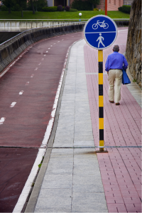
According to Smart Growth America, “Complete Streets are streets for everyone. They are designed and operated to enable safe access for all users, including pedestrians, bicyclists, motorists and transit riders of all ages and abilities. Complete Streets make it easy to cross the street, walk to shops, and bicycle to work.”
Many cities in Florida have already begun the work to create complete streets. When FDOT would come in with their projects, the local governments would tell them that the FDOT plan had to change to plug into the local government’s complete street plan. For the most part, FDOT didn’t know what to do. It didn’t have a plan; all it had was its usual inflexible bureaucracy.
In September 2014, FDOT announced a change in policy in order to allow for (or create) complete streets as appropriate in its projects going forward. The policy statement recognized that a “complete street” couldn’t just mean allowing pedestrians and cyclists more space to move around. Rather, a complete street would have to include the needs of freight, motorists, transit as well as cyclists and pedestrians. The policy provides that FDOT will work with local governments and MPOs to protect the great places here in Florida. It truly was a major policy change, and even FDOT’s new secretary, Jim Boxold, is on board with the change, recently saying it is “absolutely essential.”
Since putting out the policy statement, FDOT has begun working on crafting a Complete Streets Plan. Each FDOT district secretary was asked to serve on the implementation team to assist in making the complete streets effort work. Transportation industry specialists and local government staff participated as well.
Additionally, FDOT had multiple workshops, each dealing with different issues. Individuals and groups could both provide input about their own concerns as well as learn about other issues they might not have been aware of. For instance, bicycle/pedestrian planners and freight planners have different needs and goals. Recognizing tradeoffs would have to be made, FDOT hoped these workshops could bring these groups together to formulate a complete plan.
The proposed Complete Streets Plan uses the ITE Manual on Designing Walkable Urban Thoroughfares as a template, and works to create complete streets that are tailored to different types of urban, suburban and rural environments. The goal is to design streets that are correct in the context of their physical location, and to be able to be flexible enough to see what the community needs. For instance, a community in Miami wanted larger sidewalks and without the addition of bike lanes. FDOT fought this, since its existing inflexible plan mandated a bike lane on that type of road. Eventually, after many discussions, FDOT went with what the community knew it needed. Now the community is happy, pedestrians and retailers are happy, and with wider road lanes, the bicyclists are happy as well.
Taking lessons from these experiences, and using ITE’s model, FDOT says it is using transect planning to design complete streets. The essence of this is that everything has its place: low speeds, low volumes, high speeds, separate lanes, retail, large sidewalks, bike lanes, and on street parking improvements all must fit the places where they are being put. How this flexibility will fit into FDOT’s proposed Complete Streets Plan remains to be seen. The Plan is expected to be complete and issued to the public by the end of this month.
Meanwhile, to get the public to support changes to roads, FDOT is also revising its typical data-driven approach to focus more on the context of the individual street—what is happening now, and what needs to change to make users feel safer. Ordinarily, crash data would be used to justify an improvement to a roadway. But this really isn’t enough to convince the public that the construction is worth it. So today, FDOT is focusing on the bigger picture – changing the character of the roadway in a way that is appropriate for the context. This means looking at the existing character of the particular corridor, and identifying the solutions necessary to change the roadway’s environment and make pedestrians and others feel safer.
To identify the context of the roadway and the needs for the corridor, transportation planners should collect crash data, but more importantly they should be collecting use data, such as pedestrian crossing data-where are they crossing (at corners? midblock?); WHY are they crossing (what are the adjacent land uses?); WHO are the pedestrians (residents living in the corridor? those from farther away?); and WHERE are the transit stops and who is using them and when?
With that data, the necessary improvements can be targeted. And since even small changes can make a huge difference in making a road complete, these targeted and context-driven roadway improvements should make sense to both the engineers and the public, and meet the goal of creating a safe environment for all road users.
Anne Pollack practices in the areas of land use, real estate, environmental and governmental relations, and represents both private and governmental clients in connection with the sale, acquisition and development of real estate. She has resided in the Tampa Bay area since moving from the San Francisco area in 2003.